THE INVASION COAST WALK
For centuries, the Romney Marsh has been in the frontline whenever invaders threatened – the Roman legions, the Anglo-Saxons, the Vikings and the French all tried, and of course the Germans in 1940.
Our closeness to mainland Europe, our flat shores and hinterland and the easily accessible beaches explain the area’s appeal to today’s more peaceably inclined visitors.
The 20 mile stretch of coast from Hythe to Dungeness Point shows many signs of how our ancestors defended the land, and you can walk almost 13 miles of it – not necessarily all at the same time!
DUNGENESS TO LYDD-ON-SEA (about 3 miles)
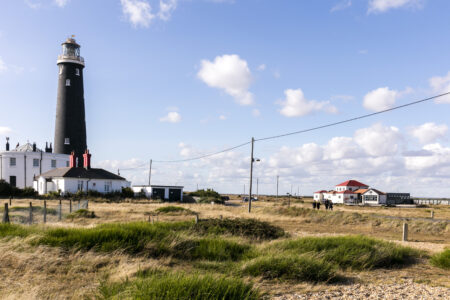
Starting at the car park at the Dungeness Station on the Romney, Hythe & Dymchurch Railway, you can see the Old Lighthouse (open to the public and the views are worth the climb!) to the south and Dungeness Redoubt and the RNSS cottages to the northwest. The octagonal Redoubt was built from earthworks in 1798 to support the four armed batteries in the area.
The 11 cottages that stand inside the Redoubt were built to house the Royal Naval Shore Signal personnel who manned the station next to the Old Lighthouse.
The walk along the single-track road takes you past old fishing boats, fascinating architecture and shingle packed with interesting flora and fauna before you join the main road from Lydd to Lydd-on-Sea.
LYDD-ON-SEA TO GREATSTONE (about 3 miles)
The walk along Coast Drives takes you past the Pilot Inn (great fish and chips!), with the shingle and sea on your right. To your left is Lade Fort, built in 1798.
Look northwest and you will see the Sound Mirrors, the precursor to radar. You can access them via a footpath here, or wait until you are further along the coast to get closer.
Further on, you will spot the three PLUTO bungalows which were part of Operation PLUTO (Pipeline Under the Ocean) – instrumental in the success of the D-Day Landings, these pipelines beneath the English Channel provided fuel to the landing force. To protect the pipelines and their pumping stations, the installations were disguised as bungalows, gravel pits, garages and even an ice cream shop to prevent the Germans from identifying their actual use.
The route leads you into the Dungeness Nature Reserve and Greatstone Lakes where you can get closer to the sound mirrors.
Keep going past The Jolly Fisherman and finish at Littlestone Greens.
GREATSTONE TO ST MARY’S BAY (about 2.25 miles)
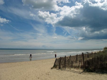
Starting from Littlestone Greens with its beach huts and children’s play area, walk along by the sea until you reach the start of the Sea Wall.
At low tide you can see part of a Mulberry Harbour, a portable temporary harbour which enabled the British and Americans to land troops and equipment onto the Normandy Beaches. This section is remarkably intact and is now an Ancient Scheduled Monument.
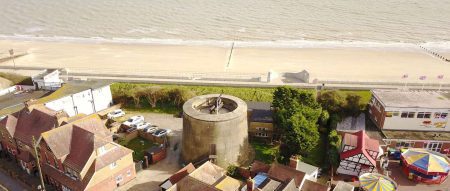
About half a mile further on, there’s an extraordinary 120ft tall redbrick tower. Built as a water tower in 1890 by Henry Tubbs to supply water to his properties, it was used as a lookout post in World War Two.
Continue along the sea wall, with the village of St Mary’s Bay on your right until you reach the outskirts of Dymchurch.

DYMCHURCH (about 3 miles)
Dymchurch is home to not one but three of the surviving Martello Towers. The first one you come to, No.25, is in one of the village car parks and currently undergoing renovation.
Five minutes further along and you reach No.24, considered to be the best surviving example, and which can be seen as it was when occupied by the military in 1806. Owned by English Heritage, it is open to the public on selected days – for more information on opening times, visit www.english-heritage.org.uk/visit/places/dymchurch-martello-tower
Dymchurch is a great place to stop – a funfair if the kids are tired of walking and history, as well as a selection of pubs, cafes and fish and chip shops.
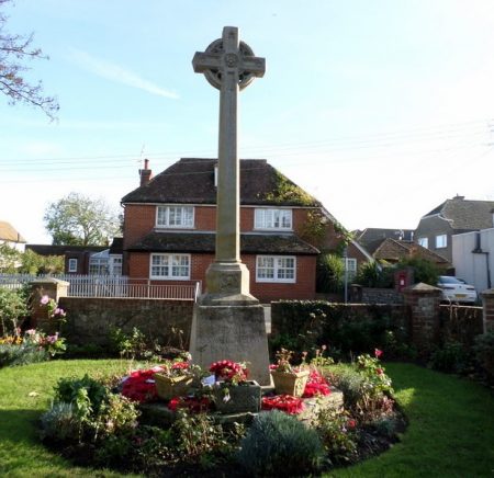
If you divert by walking across Sycamore Gardens with its little green and beautiful houses you’ll find yourself opposite the War Memorial and St Peter and St Paul’s Norman Church as well as New Hall.
New Hall dates back to when Dymchurch was the headquarters for law and order on the Marsh, and from where swift justice was meted out to those who transgressed.
Back on the Sea Wall and turning left you come to Martello Tower No.23, now a Grade II listed building and converted into a private home. A fourth was demolished in 1956 when the main A259 road was widened.
DYMCHURCH WALL TO DYMCHURCH REDOUBT (about 1.5 miles)
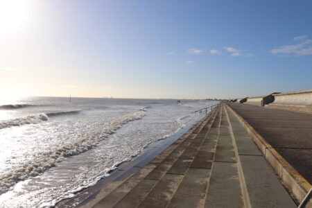
Around half of Romney Marsh’s coastline is defended by sea walls, the oldest – and newest – of which is the Dymchurch Sea Wall.
Dymchurch has had a seawall since Roman times, originally constructed from blackthorn to protect the harbour at Port Lympne and then later to protect the Marsh itself which would otherwise have been underwater.
Today’s wall was completed in July 2011, at a cost of £60million as part of a wider sea defence strategy.
Your walk finishes at Dymchurch Redoubt, a supply depot for the nearby Martello Towers and a fortification in its own right, which was built between 1798 and 1809.
PRACTICALITIES
Car parks are adjacent to the walk at Dungeness, Lydd-on-Sea, Greatstone, Littlestone, St Mary’s Bay and Dymchurch.
The 102 bus route runs alongside most of the walk as far as Lydd-on-Sea. www.stagecoachbus.com/about/south-east
The Romney, Hythe and Dymchurch Railway has stations at Dungeness, Romney Sands, New Romney, Romney Warren, St Mary’s Bay, Dymchurch and Hythe. www.rhdr.org.
For much of the walk it is advisable and sometimes necessary to keep your dog on a lead. Check local signage for full information.
For more information visit www.romneymarshhistory.co.uk/invasioncoastwalk